Research / Brightsite
The valley gets a skyline
The peak comes out of the haze, the hills carry on beyond the lake, and the valley begins to feel like one connected place.
- Published
- BrightsiteWorld in development
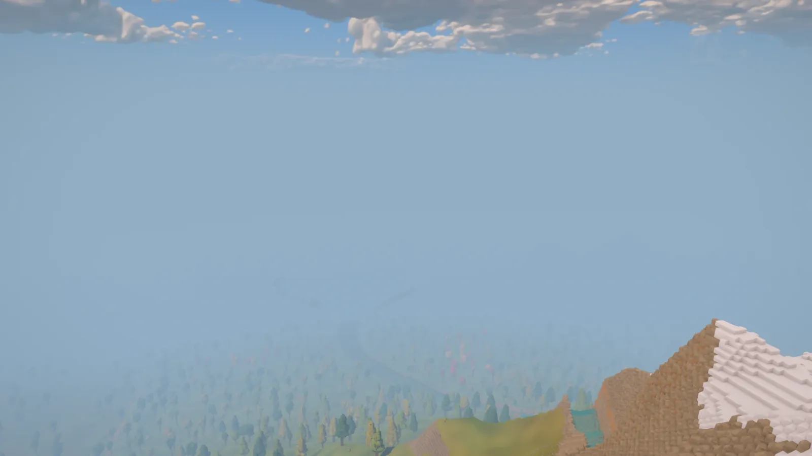
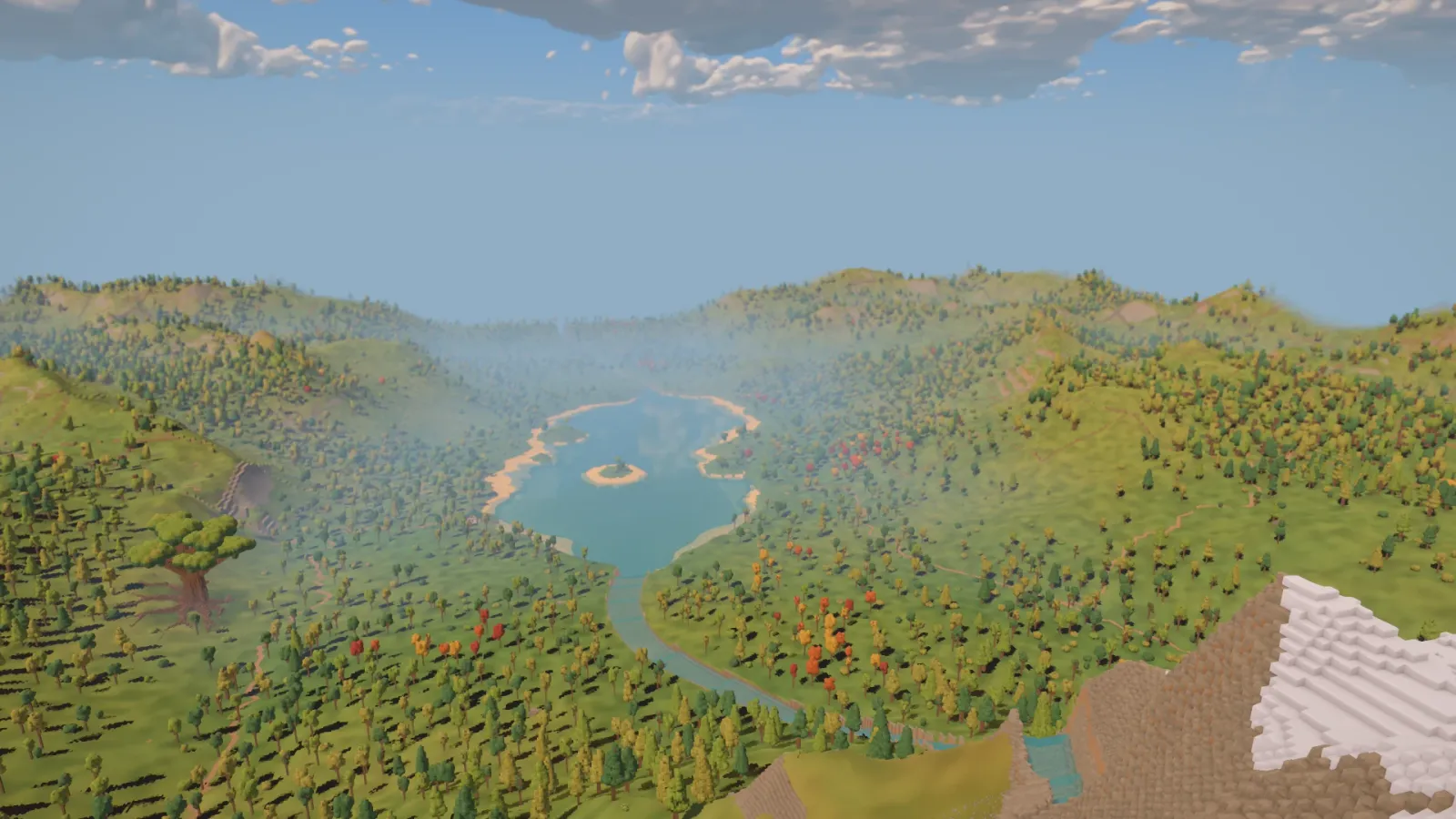
There has always been a mountain beyond the green. Today it became part of the view.
The valley used to fade into a wall of haze before its furthest landmarks could be seen. The peak was there in the landscape, but standing near the arrival gave little sense of its shape or how the hills fitted together beyond it. Today’s work opens that view, carrying the land out to the edge of the map.
The peak beyond the green
The change is easiest to see from a familiar place. Beside the timber granary, the snowy mountain now rises behind the trees. It gives the green a backdrop and a landmark to keep in mind while moving through the valley.
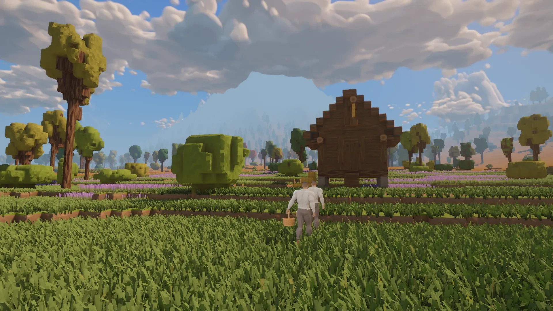
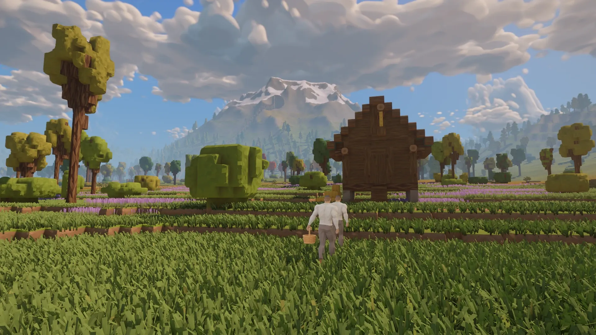
Before After
The same camera position before and after the skyline work, with noon lighting and the clock held.
The fog now thins with height. Low ground around the town and lake keeps its haze, while ridges and the peak emerge above it. That difference gives the valley more depth: a place nearby can remain sheltered in the mist while a high landmark stands clear beyond it.
Hills that carry on
A simpler version of the distant land now fills the view beyond the detailed scenery. From the summit, the river, lake, woods and rim of hills can be read together. It becomes easier to see where a stretch of forest sits in relation to the water, or how the valley bends away from the ground underfoot.
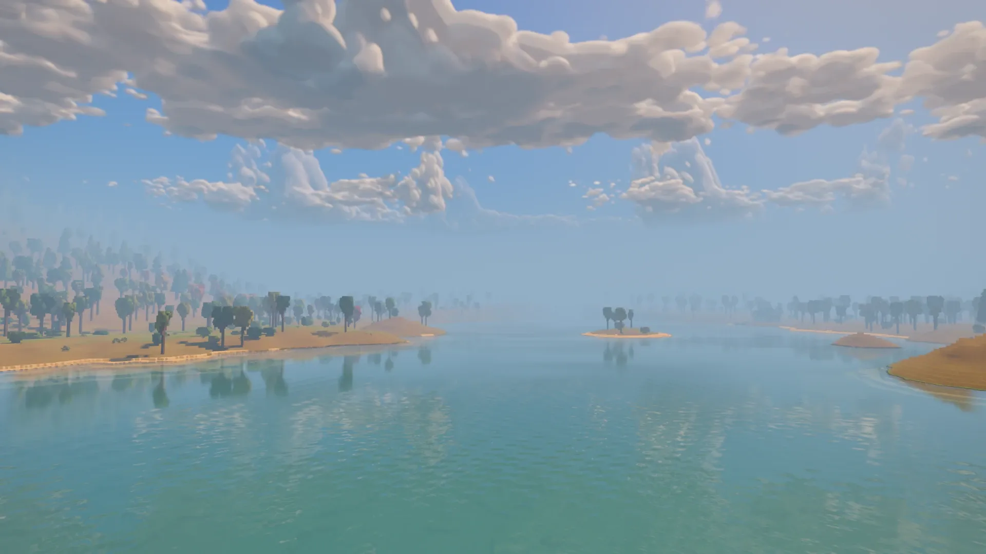
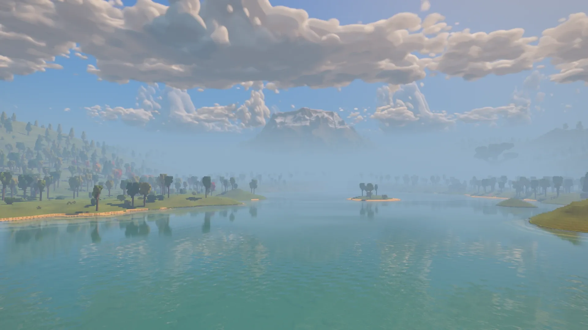
Before After
The same view up the lake before and after. Low haze remains over the water while the higher ground becomes visible.
Distant slopes keep their grassy appearance, broken into broader patches of lush and dry ground. Far trees also cast shadows beyond the reach of the nearer shadow maps, giving the woods a darker floor and keeping their shapes readable across the valley.
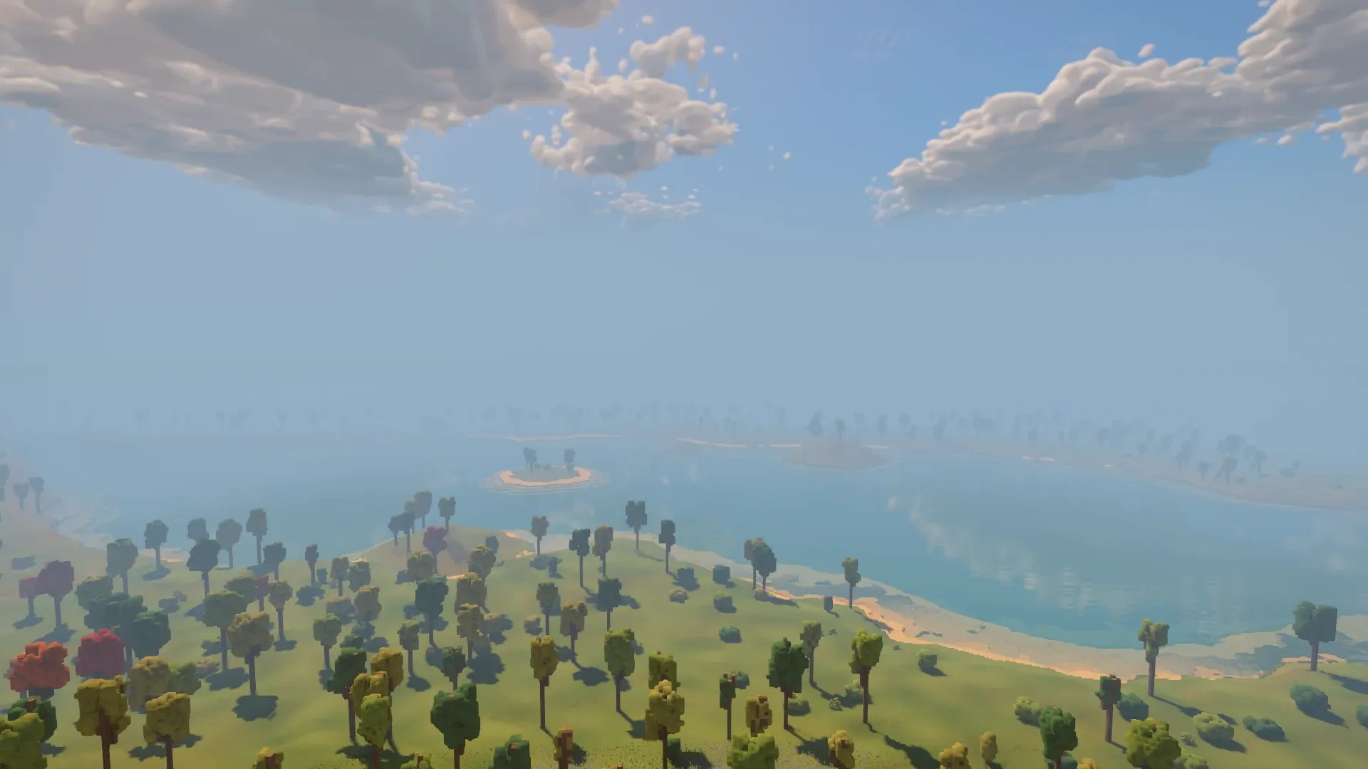
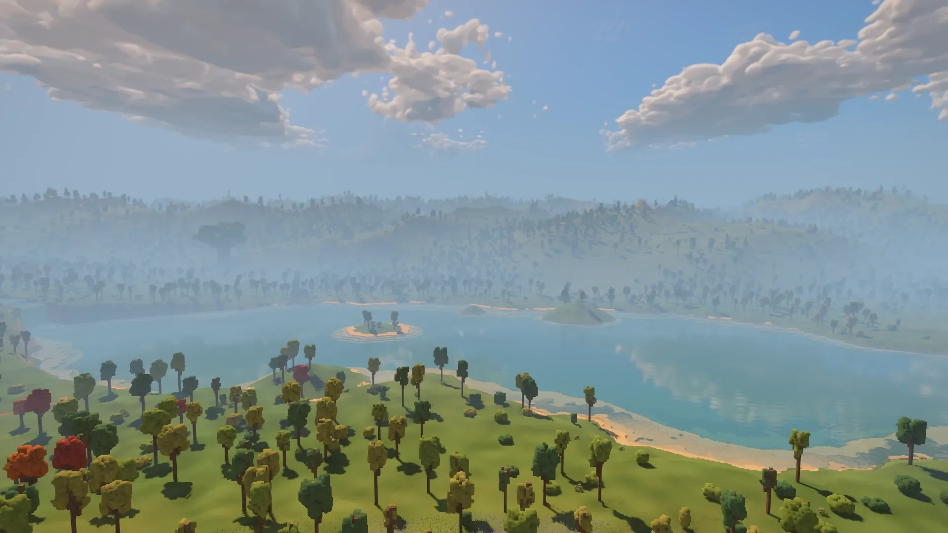
Before After
Across the lake from the western woods: the far shore now has hills behind it, with tree shadows and patches of grass carrying into the distance.
Four people to call it home
The valley also opens with its first four settlers: two farmers, a forager and a woodcutter. They have beds in the cottage, workplaces ready and two days of food in store. The fields start at different stages of growth, so the first harvests come a row at a time.
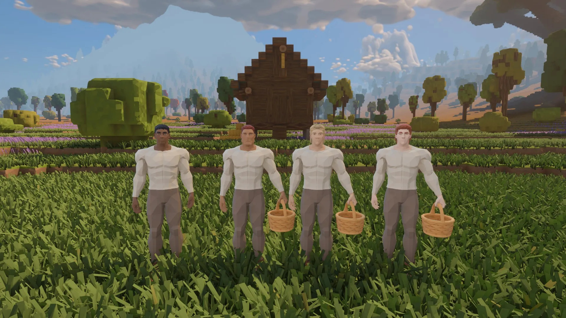
The founding four, gathered before the granary: the people who begin keeping this corner of the valley fed and supplied.
Making room for the view
The longer view comes with work behind it. Faces turned away from the camera can be left undrawn, and distant meshes are built around what their surfaces look like. Hidden menu windows also wait until they are opened, reducing work while walking through the world.
Alongside this work, we moved to Bevy 0.20 and Avian 0.8, updating how groups of entities are cleared and rendering data is handled.
There are still edges to finish. Building or felling far away does not yet carry through into the furthest scenery. Beyond the nearer shadow maps, the mountain still lacks its evening shadow across the valley. A faint seam across the lake, visible from the summit, also needs attention.
For now, the peak, the lake and the green belong to a much more readable whole: somewhere with a horizon to look toward, and a view worth looking back at.
The skyline work was completed on October 23 and landed on main the following morning. The skyline images are existing development captures preserved with October 24’s review: 1920×1080, noon, clock held, on an RTX 5070 Ti. All four before/after pairs use matching camera positions. The founders’ portrait was supplied separately on October 24. The furthest scenery is a visual backdrop; these images do not demonstrate distant collision or editing.